Point Pelee National Park
Point Pelee is located at the southernmost point of the Canadian mainland. You can view flocks of migratory birds in the spring and waves of vivid Monarch butterflies in the fall seasons. You can still hike in the winter and enjoy sandy beaches in the summer. There is something to do all year. It is known for an ecologically diverse national park. People usually hike, bike or paddle here.
Directions and address to Point Peele National Park
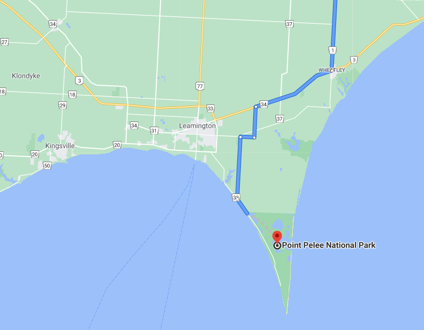
Point Pelee can be reached by car. It is around 65 km from Windsor, 355km from Toronto and 180 km from London. Roughly it takes 3.5 hours from Toronto.
Address for GPS: 1118 Point Pelee Dr, Leamington, ON N8H 3V4
From the east (via Highway 401) :
- Hwy 401 to exit 48 (Cty Rd 35/Hwy 77, Leamington, Comber). Take exit and turn left (south) on Hwy 77
- Follow Hwy 77 to Hwy3/Cty Rd 33.
- Turn left (east) on Cty Rd 33**
- Follow Cty Rd 33 to Cty Rd 20. Turn right on Cty Rd 20
- Follow Cty Rd 20 approx 200 m to stop sign at Bevel Line
- Turn left on Bevel Line. This road will become Point Pelee Drive.
- Follow Point Pelee Drive to the Park Entrance
Hours of Operation
Point Peel Park is open from 7 am to sunset, every day.
Admission fee
Daily (From April to October)
- Adult $ 7.90
- Senior $ 6.90
- Youth free
- Family/Group $ 16.00
Daily (November to March)
- Adult $ 6.10
- Senior $ 5.50
- Youth free
- Family/Group $ 12.00

Activities
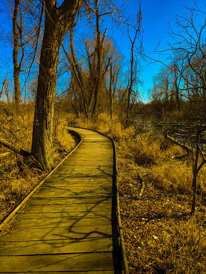
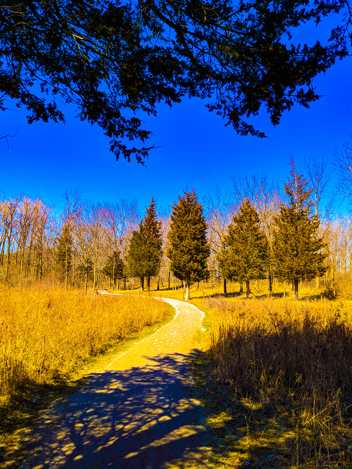
- Hiking in wooded trails
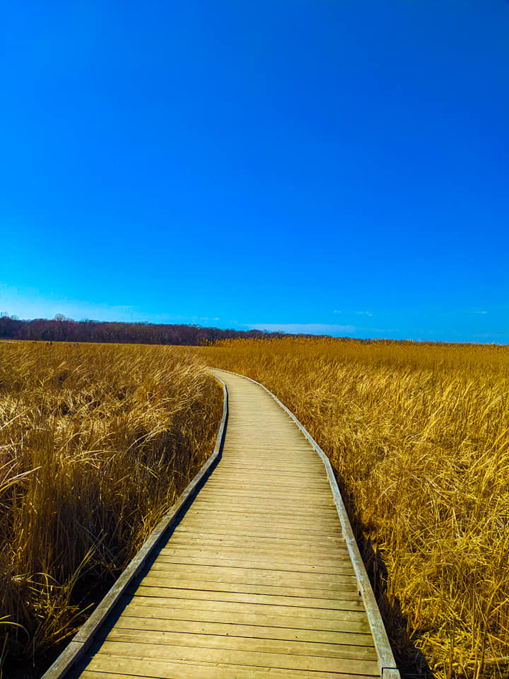
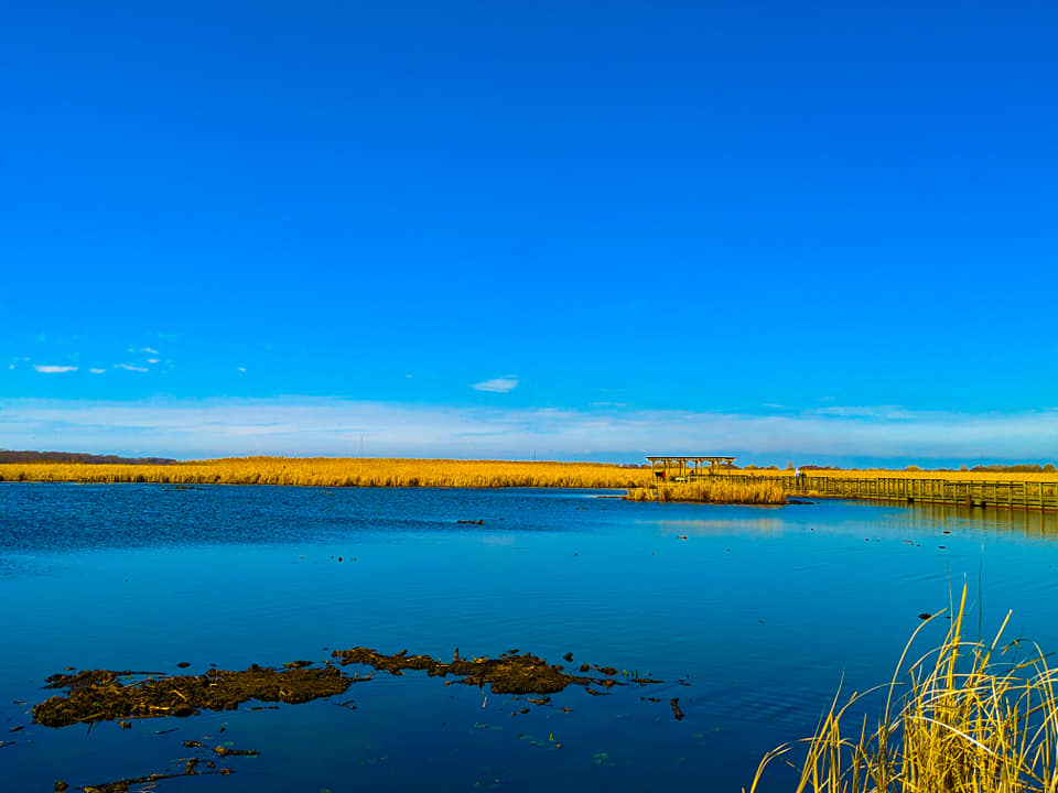
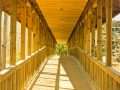
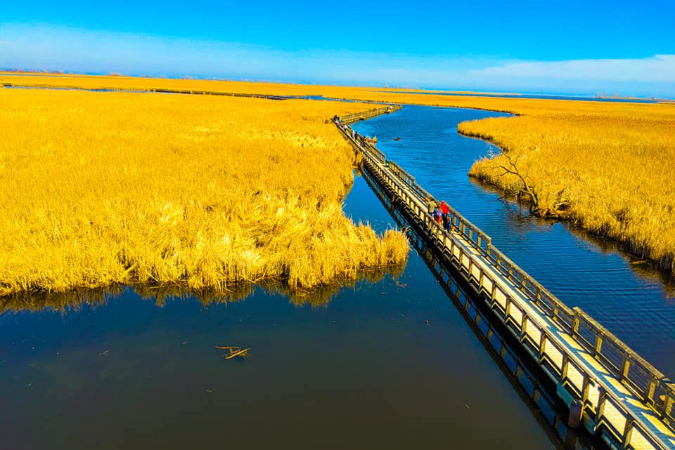
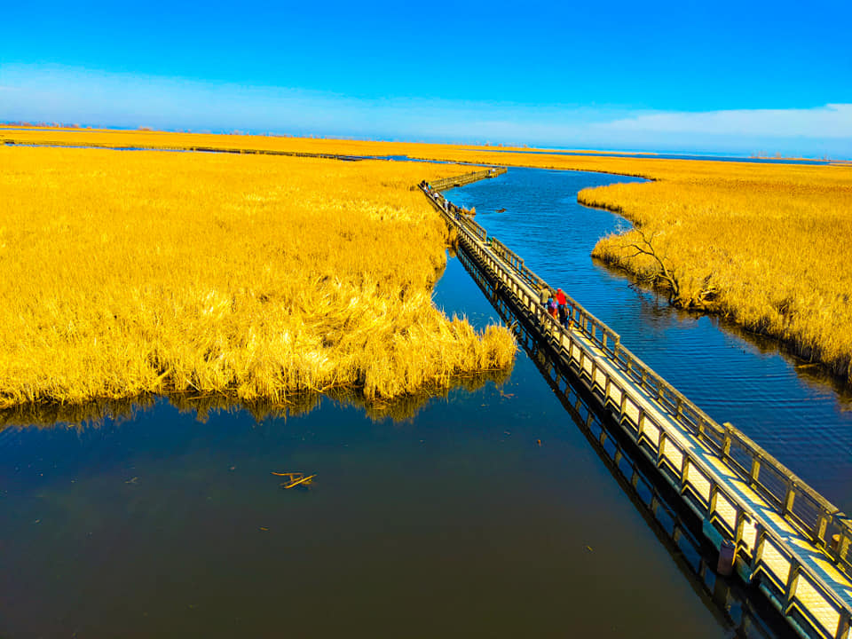
- The long beautiful floating boardwalk
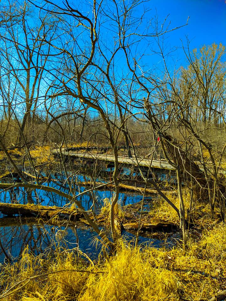
- Canoeing & kayaking through the marsh channels
- oTENTik accommodation – easy way to camp
- Rental facilities
- Learn paddling skills from park guide -check for availabilities before you go
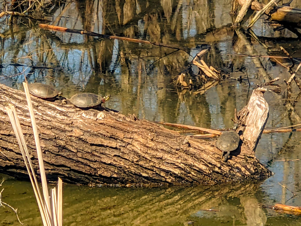
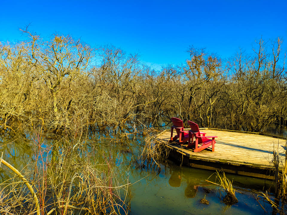
- Able to spot beavers, multiple types of turtles, muskrats, herons, frogs, dragonflies on cattails
- Bird Watching
- Picnic
- Photography
- Overnight Camping
- Swimming
- Biking
- Observation Tower

Special Features
Why go to Point Peele?
This long peninsula stretches out into Lake Erie, finishing in a sharp tip at the southernmost point in Canada. This park is stretched by marshland and beautiful forest that make it a haven for reptiles, birds and butterflies, especially during the migratory season. You can spot many types of snakes here as well.
Therefore main features here: able to see the sharp tip of the southern land, a long beautiful boardwalk with an observation deck, and butterflies in the fall and migrating birds in the spring. The rest of the features are available in other Ontario’s national and provincial parks.
Travel Advice
If you are travelling from GTA or Toronto, be prepared to spend at least 3.5 to 4 hours of driving. There are onroute/ service stations available for breaks.
Is it worth a visit?
In my opinion, it is worth going from Toronto or GTA and even from another province of Canada or the USA if you live closer to the border. If you are someone coming from another country other than the USA, I do not think it is one of the best landmarks that you must see. Your best bet would be not missing to visit Niagara Falls.
We went with small children, so we had to find accommodation for the night, but if you are able to travel back then it is doable. It depends on your ability to stay in a car for another 4 hours drive back: a total of 7-8 hours of driving from Toronto.
Estimated time
We spent almost 3 hours hiking with children, but you can do and see more at this park. If you are planning to spend time at the beach or paddling, it may take longer. You can pretty much spend a whole day here.
Trail information
There are many trails to explore, but we only completed DeLaurier Homestead & Trail which 1. 2 km Loop and took us an hour with kids.
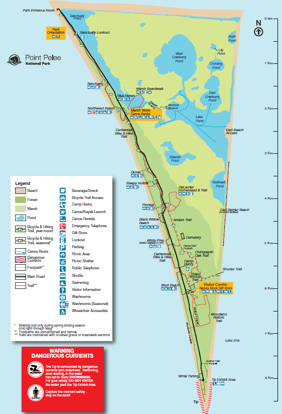
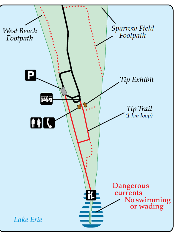
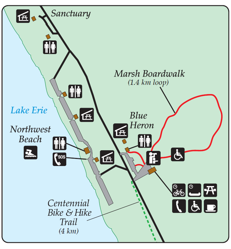

- Marsh Boardwalk – 1 km (loop) and takes around 45 minutes; cattails, red-winged blackbirds and painted turtles can be seen.
- Centennial Bike & Hike Trail – 4 km in total; 2 hours one-way hike; Shaded, walk through dry forest, beach and savannah. It goes from Marsh Boardwalk to Visitor Centre.
- DeLaurier Homestead & Trail – 1.2 km (loop), 50 minutes, and I have completed this loop in an hour with kids. It has a historic house and contains cedar savannah and swamp forest.
- Chinquapin Oak Trail – 4 km long loop; 2 hours , you can see mixed dry forest with Chinquapin oak,
- Shuster Trail – 0.5 km, 15 minutes- short trail
- Tilden Woods Trail – 1 km (loop), roughly takes 45 minutes. It begins at the Visitor Centre parking lot and you are able to see mature swamp forest and cedar savannah.
- Woodland Nature Trail – 2.75 km and it is a loop that takes roughly 1 hour. It starts behind the Visitor Centre.
- Tip Trail – around1 km long loop and takes 20-40 minutes to hike. Shuttle buses are usually available from the Visitor Centre and it will drops you off at the Tip of the park.
See more pictures of Point Peele National Park